Siskowit Mining Company
By: Lawrence Rakestraw
his company went through a series of early changes, beginning as the Isle Royale Union Company in 1844, reorganizing as the Siskowit Mining Association in 1847, and becoming the Siskowit Mining Company in 1849. For our purposes we can consider these companies as the same. In its final form it was incorporated in Michigan, with directors from Washington, D.C., Wisconsin, and Philadelphia, and had Charles Whittlesey, an eminent geologist and business man, as agent. Preliminary explorations were carried on in 1844, but little was done until 1846. In that year the company established headquarters in an old fishing cabin (possibly remaining from the American Fur Company venture) across from Mott Island. The agent, together with his work force of a blacksmith, a carpenter, and two laborers, explored Mott and Outer Hill Islands. They excavated 600 pounds of rock, discarded 200, stamped the rest with the aid of a beach boulder and a swing pole, and recovered rock having 15% copper in it.
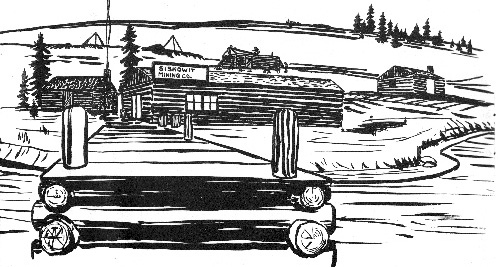
Siskowit Mining Co. as it may have appear in 1847: Steven Viers, ISRO Archives.
But soon they abandoned this location for a more promising one on the main island. During the winter they sank a shaft in a vein of chlorite and epidote near the cabin and about 80 yards from the shore. The next year they blanketed the north shore with locations from Washington Harbor to McCargoe Cove, in many cases taking over prospects abandoned by other companies. Of these north shore locations only one proved to be profitable, a combination silver and copper mine near McCargoe Cove. They excavated a drift here for sixty feet and began stoping, recovering some silver and copper; but this mine seems to have been abandoned by 1849.
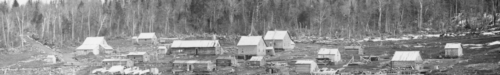
By 1850 work centered in the Rock Harbor location across from Mott Island. The settlement soon included a large hewed log house for the agent, numerous shanties for the workers and their families, and a log storehouse with barracks in it for a dozen single men. A steam stamp mill was set up in 1850 with water obtained from the lake by means of a large Cornish pump. The original vein was abandoned for another about 200 yards to the north and east, where a long adit was dug to lake level for drainage, and several shafts sunk along the vein. The deepest reached 360 feet.
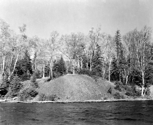
Siskowit Mine Ruins, 1964: Dumire [NVIC:60-298], ISRO Archives.
F.C.L. Koch, German mining engineer, 1850:
"This copper lode is about two and one half feet thick, but the copper has penetrated into the foot and hanging wall beyond and outside of it. At many points the copper occurs in thin plates, which now and then thickens to larger pieces, up to several pounds in weight...since the mine furnished principally stamp rock, the steam engine just put in place, by which the stamp mill, etc., are to be run, will meet one of the most pressing needs. Considerable of the coarser masses of copper have already been sold, and they figure on a product of about 30 tons up to the close of navigation. The elevation of the point where the mining is at present being pushed, above the level of the lake, is inconsiderable, perhaps only 30 to 40 feet; if one does not shortly have to fight too much water, this field may perhaps give favorable results. At that time ten miners were employed, and thirty odd people in surface work."
Citation:
- Rakestraw, L., United States., & Isle Royale Natural History Association. (1965). Historic mining on Isle Royale. Houghton, Mich.: Isle Royale Natural History Association in cooperation with the National Park Service.